Drone Operation and Photogrammetry
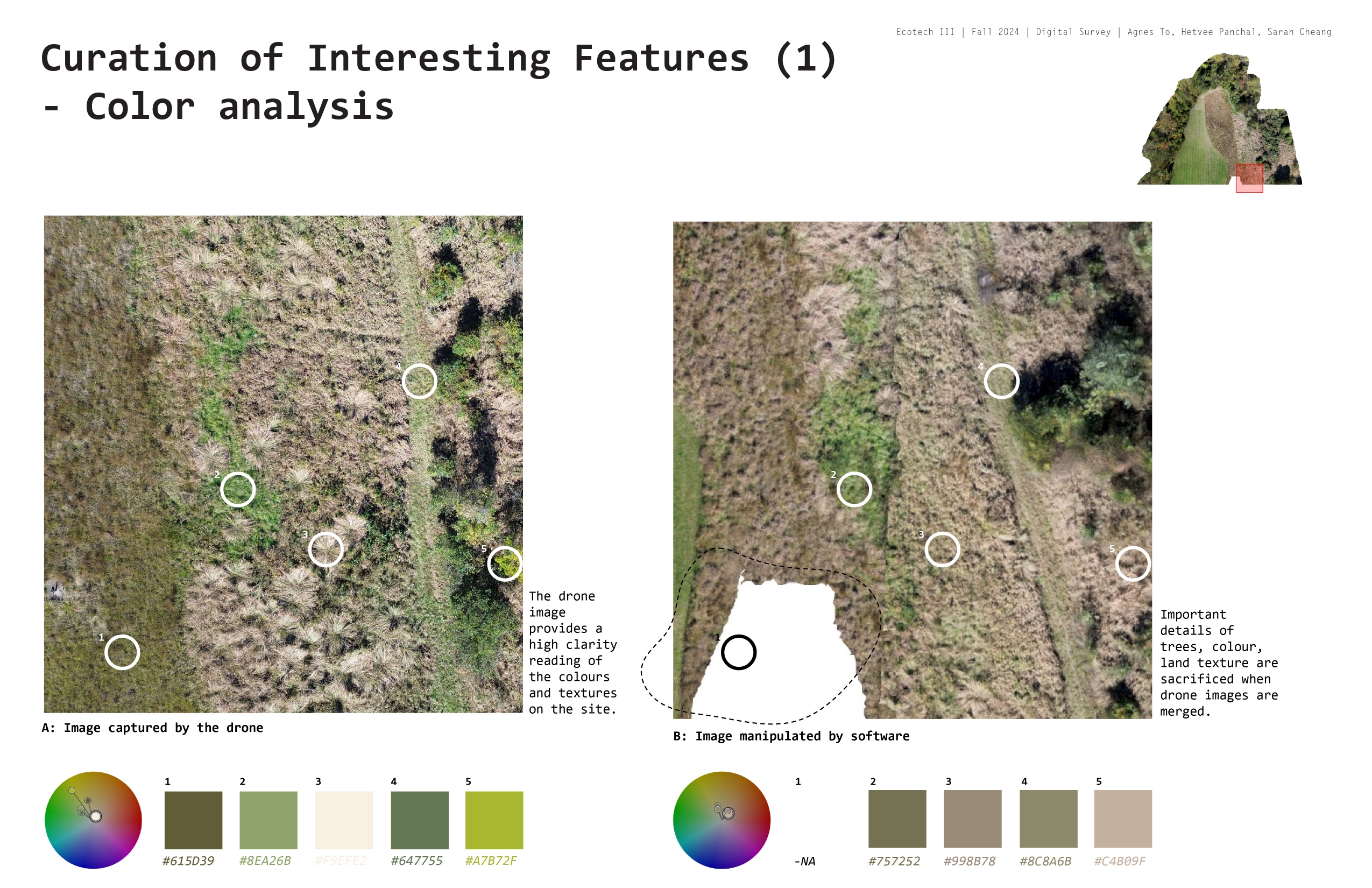
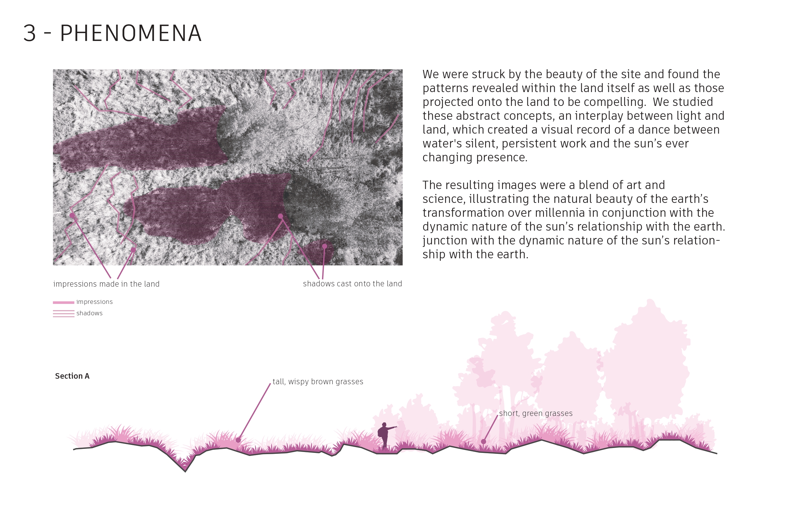
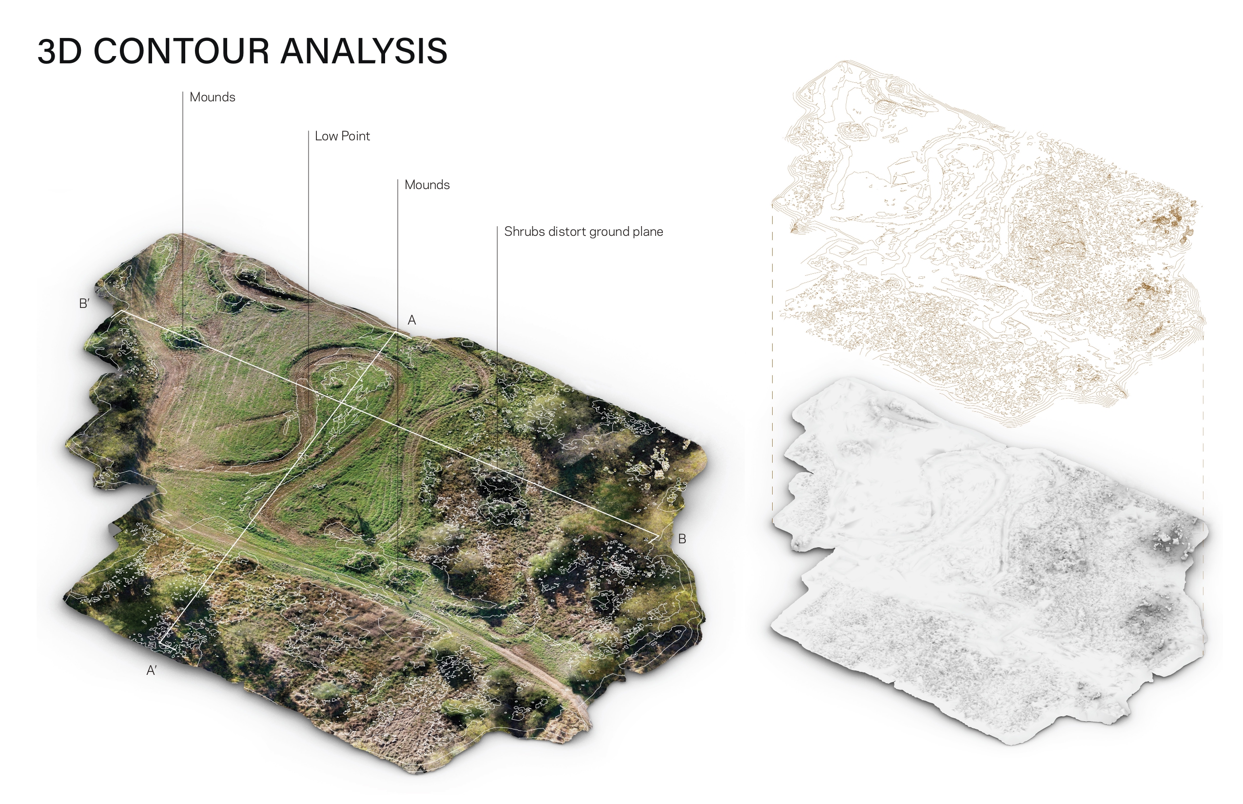
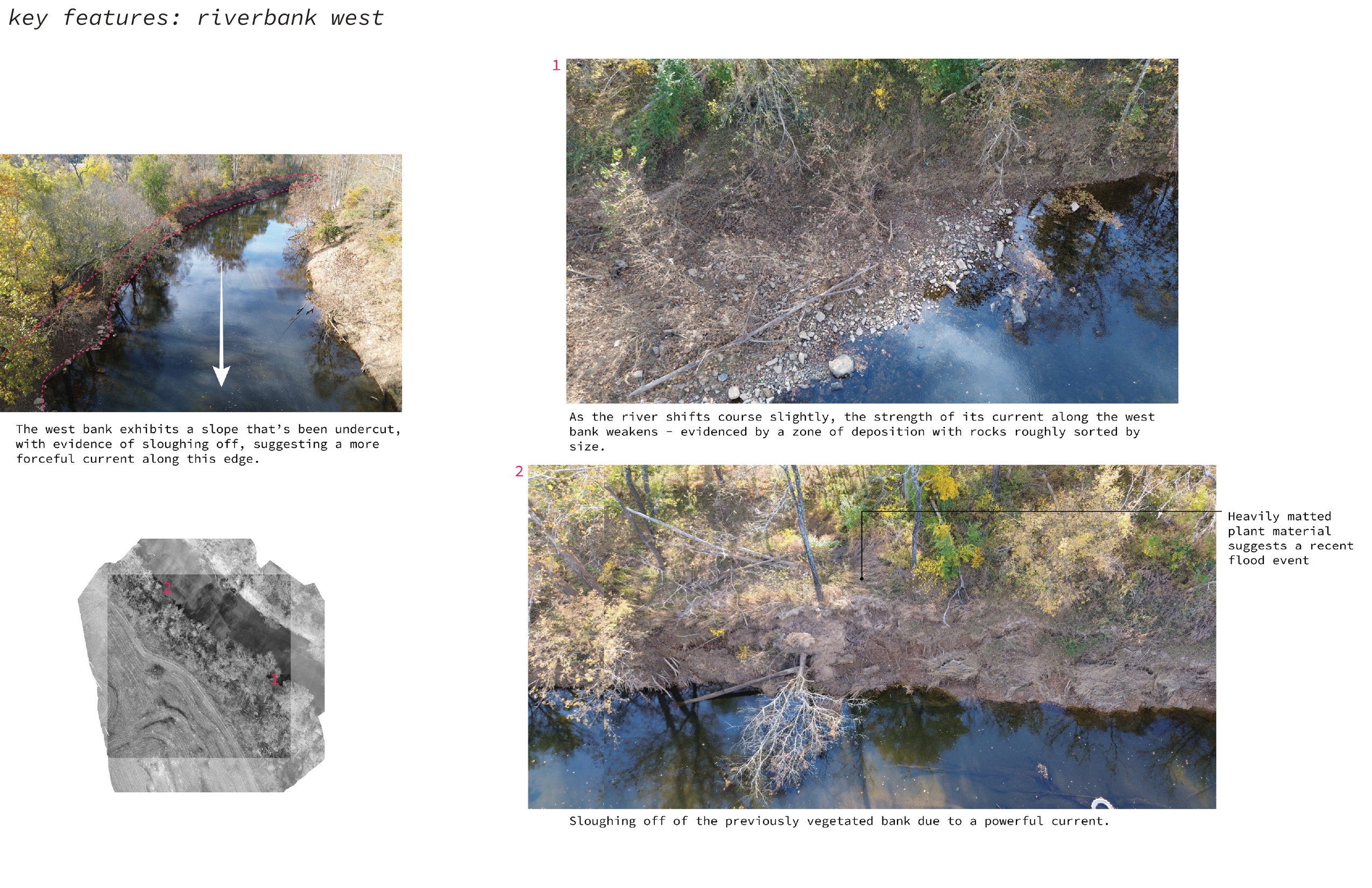
Pairs of students were asked to perform a site survey of a portion of Milton Airfield utilizing a drone and photogrammetry. Photogrammetry is the art, science, and technology of obtaining reliable information about physical objects and the environment through processes of recording, measuring, and interpreting photographic images. The operation of a drone was required to capture the photographic data to be fed into Autodesk ReCap Photo (or similar software) for constructing the following through photogrammetry: 1) an orthographic image 2) a 3d model that will be subsequently brought into hino for basic analytical operations (contours, sections, dimensions, etc) 3) curating any features, elements, or phenomena of interest through simple photography, leveraging the point of view and accessibility of drone operation.

2B
Sarah Cheang, Hetvee Panchal, Agnes To


2D
Hayoung Ju, Yujie Liu, Chenxuan Yang3B
Veronica Estrada, RebeccaKeteltas, Laura Whitaker


3C
Aileen Frazier, Emma Reed, Ruth Shatkay
3B
Alex Fry, Alex Heald


4D
Alex Daley, Hyun Joo Shin